AGRICULTURE
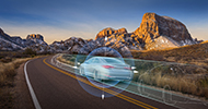
Another potential aiding source is the use of photogrammetry or using vision-aided navigation. In a vision-aided navigation system, imagery is used to provide position information to a navigation system. Images from a camera are processed by the navigation system to recognise and track objects in the environment.
There are two ways this can be used. Known surveyed camera targets can be used to generate an absolute position in a certain environment or everyday objects can be used as control point. When an object is recognised by the system, the relative change in successive images can be used to generate a relative position change of the camera in 3D space.
This means that a vision-aided system can be combined with a GNSS+INS system to provide position and attitude updates to the INS when GNSS updates are not available. An example application for a vision-aided navigation system is an autonomous vehicle used to carry a load from a yard into a warehouse. When the autonomous vehicle is outside, the GNSS+INS provides the navigation for the vehicle. When inside the warehouse, the vision-aided system uses known features/targets within the building to provide position updates to the INS.